Upper Nepean
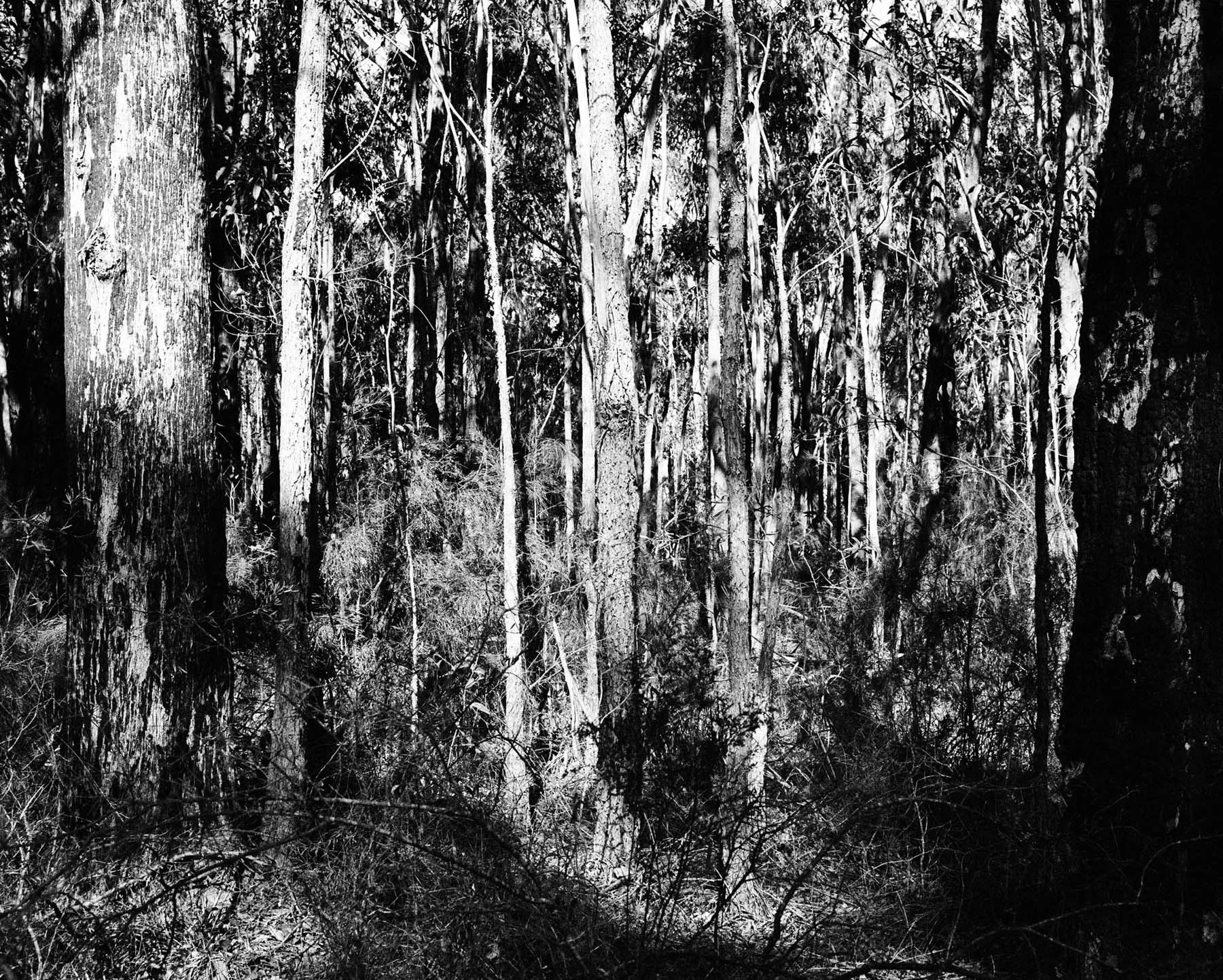
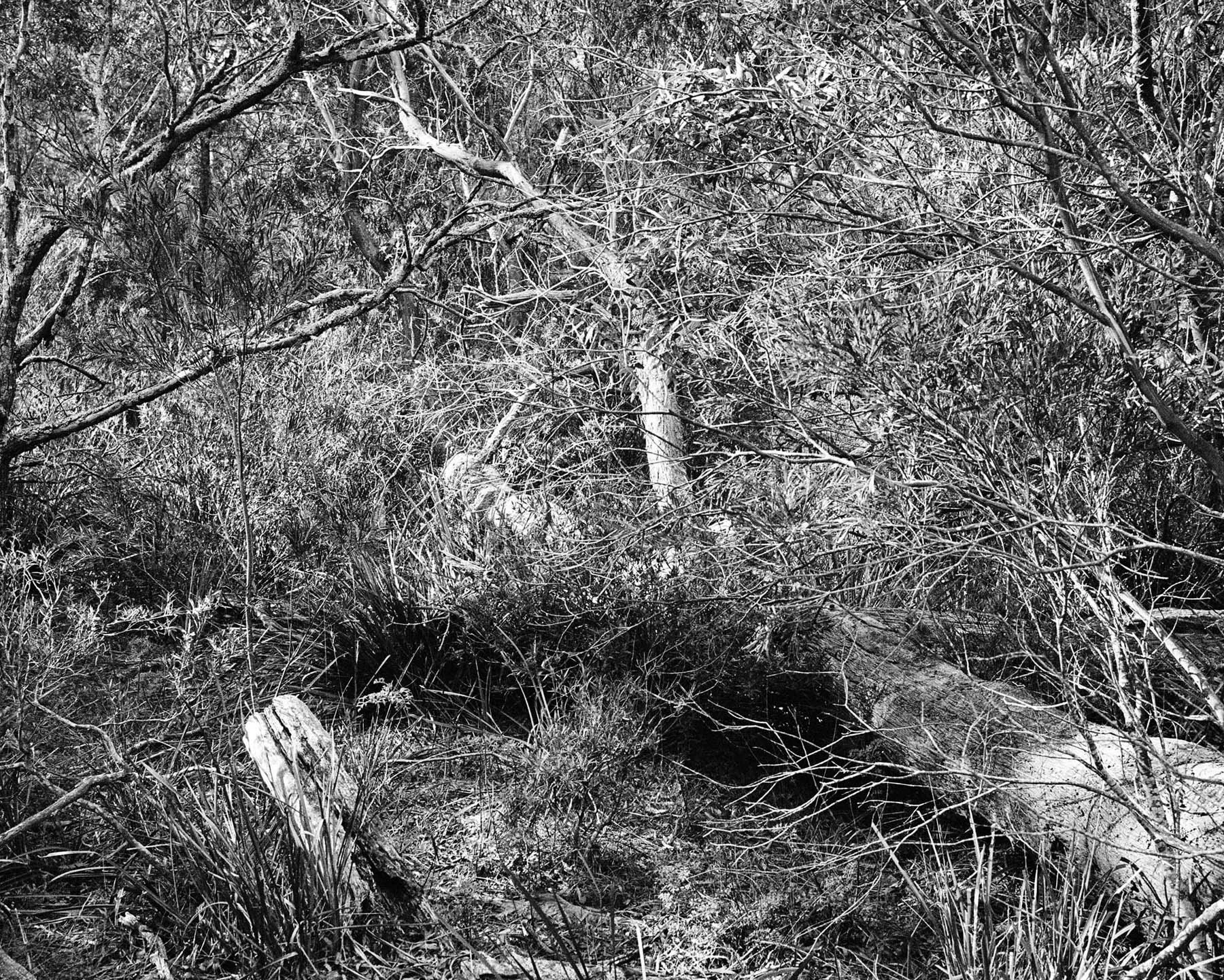
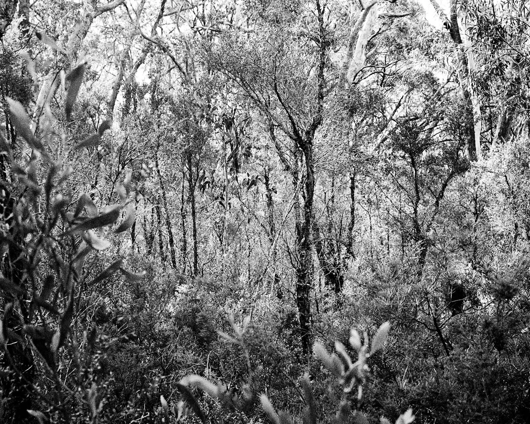
The Upper Nepean catchment spans almost 900 square kilometres of protected bushland across the Illawarra Plateau south of Sydney. Established to safeguard the city’s drinking water, it has remained closed to the public for more than 130 years. Within its boundaries, human presence is almost entirely absent. The land forms part of the Metropolitan Special Area, a vast and carefully guarded zone where natural processes unfold with minimal interruption, creating one of the most intact pockets of bushland in the region.
The catchment is home to the White Waratah, the only know location of the flower in the world. It was discovered by maintenance crew of the Sydney Water Board in 1967. Like the Wollemi Pine, its exact location has been kept secret. The boundaries of Upper Nepean are defined by dense curtains of trees and brush, bordering roads and smaller settlements.
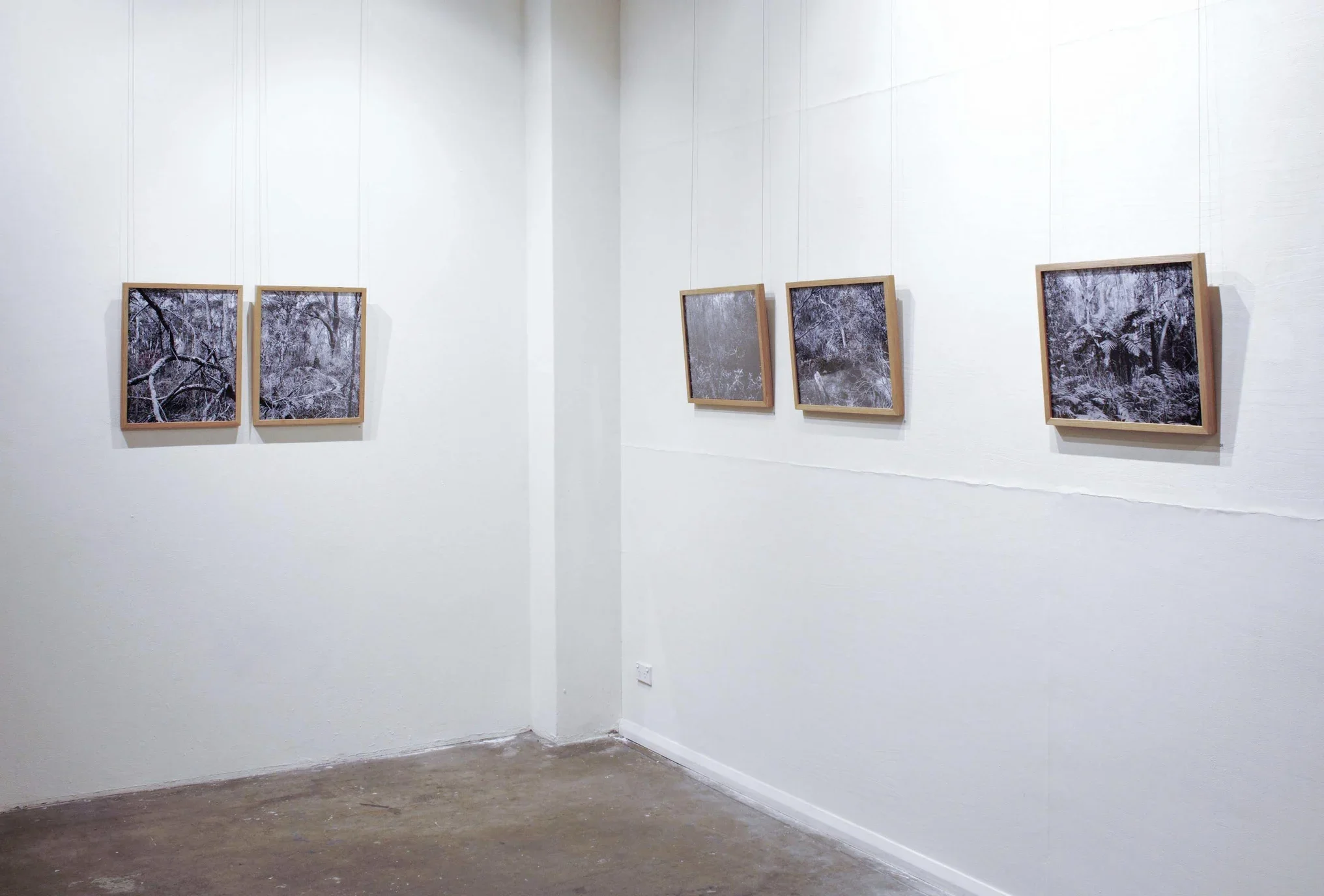
This photographic series explores the perimeter of the catchment as a charged and enigmatic threshold. The boundary becomes a place where the known world meets the unknown, where the everyday brushes against the forbidden. Standing at this edge invites speculation about what lies beyond: rare species, hidden histories, lost objects, or simply the quiet persistence of an ecosystem left largely to its own devices. The landscape appears both generous and treacherous, offering abundance while concealing hazards, its beauty intertwined with a sense of unease.
In tracing this liminal zone, the works reflect on the allure of restricted places and the myths that accumulate around them. The catchment edge becomes a site of imagination, secrecy and possibility, a reminder that even in a mapped and managed world, there remain territories that resist full comprehension.
Exhibited at Scratch Art Space in 2018.